Council District Map
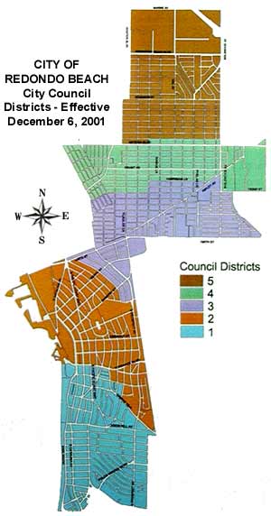
- If you live north of Matthews, you live in District 5.
- If you live west of Blossom and north of Artesia, you live in District 5.
- If you live north of Harriman and north of Ripley, you live in District 4.
- If you live in the vicinity of and west of Harper, you live in District 3.
- If you live west of Blossom and north of Marshallfield, you live in District 4.
- If you live north of Ripley, you live in District 4.
- If you live east of Inglewood and north of 182nd, you live in District 4.
- If you live north of Anita and east of PCH, you live in District 3.
- If you live north of Del Amo and east of N. Maria, you live in District 3.
- If you live north of Torrance Blvd, you live in District 2.
- If you live east of Camino Real and north of Pearl, you live in District 2.
- If you live on Camino Real and north of Camino Real and East of Wilderness Park, you live in District 1.
- If you live east of S. Juanita and north ot Camino Real, you live in District 2.
- If you got to this point without a district assigned, you live in District 1.